Downtown Manhattan Storm Surge Map
Wednesday, August 24th, 2011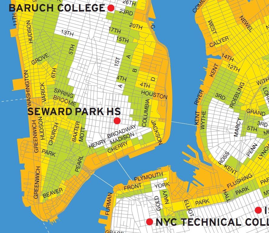
- Residents in Zone A (orange) face the highest risk of flooding from a hurricane’s storm surge. Zone A includes all low-lying coastal areas and other areas that could experience storm surge in ANY hurricane that makes landfall close to New York City.
- Residents in Zone B (Yellow) may experience storm surge flooding from a MODERATE (Category 2 or higher) hurricane.
- Residents in Zone C (Green) may experience storm surge flooding from a MAJOR hurricane (Category 3 & 4) making landfall just south of New York City. A major hurricane is unlikely in New York City, but not impossible.
Enter your NYC address to find your zone
PDF Map of entire city.

where’d you get this from? Would love to see the data for western Queens.
that looks like a nyc OEM hurricane map. found it. click on "map" in your desired language.
https://www.nyc.gov/html/oem/html/ready/hurricane_guide.shtml
I have the links in my blog post. Didn’t get around to posting them here.
Thanks.
[...] Con Ed facility on 14th Street has adequate means to thwart the storm surge, but it is in the evacuation zone, and you wonder. Salty, conductive sea water does not play nicely with electrical circuits. Co Ed [...]
btw, the nyc oem hurricane map is based on NOAA hurricane storm surge data mapped onto NYS and NYC geography. a more technical map is located at
https://www.oasisnyc.org/map.aspx
make sure the "Coastal Storm Impact Zones" data set is active (on the right hand map legend).
Nifty map.